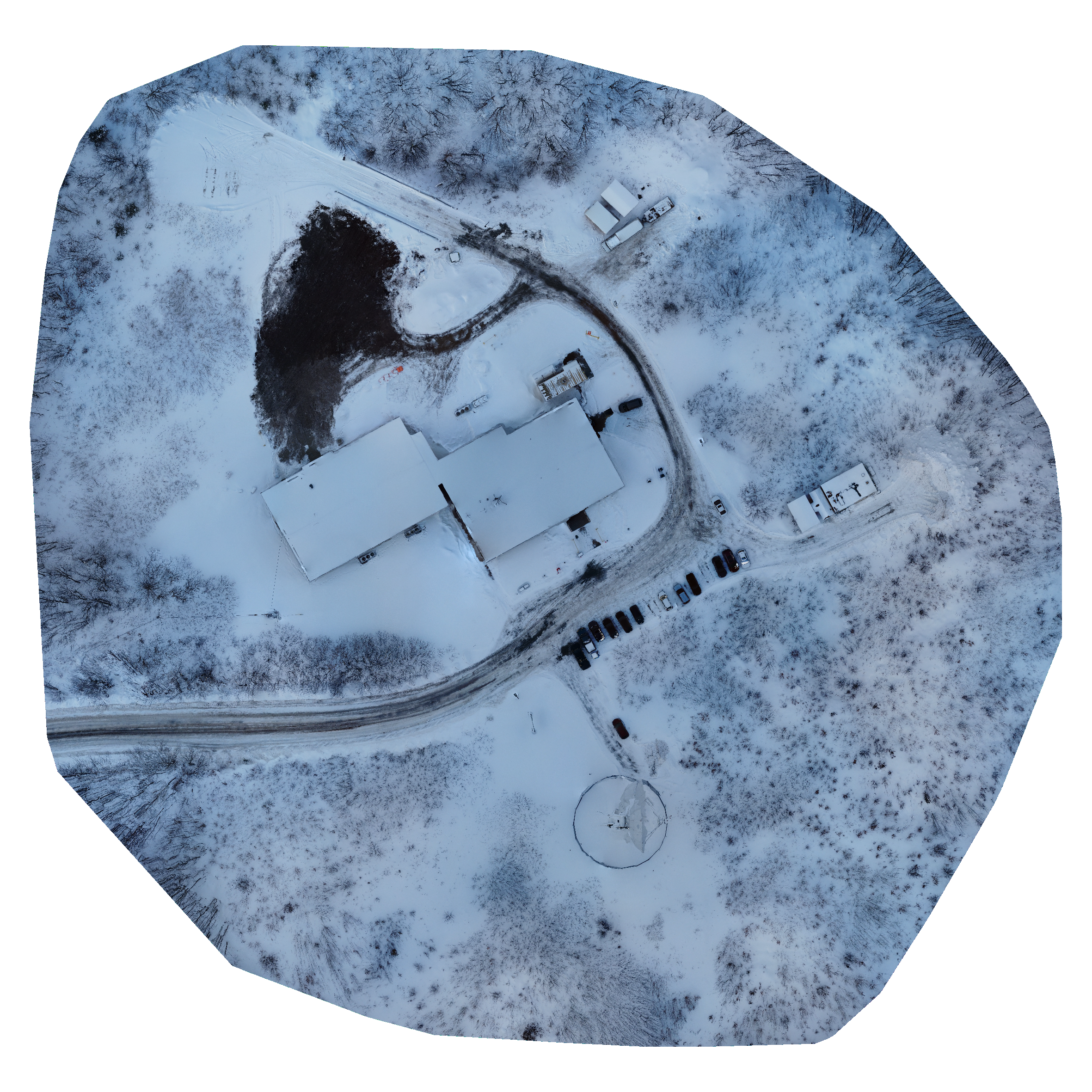
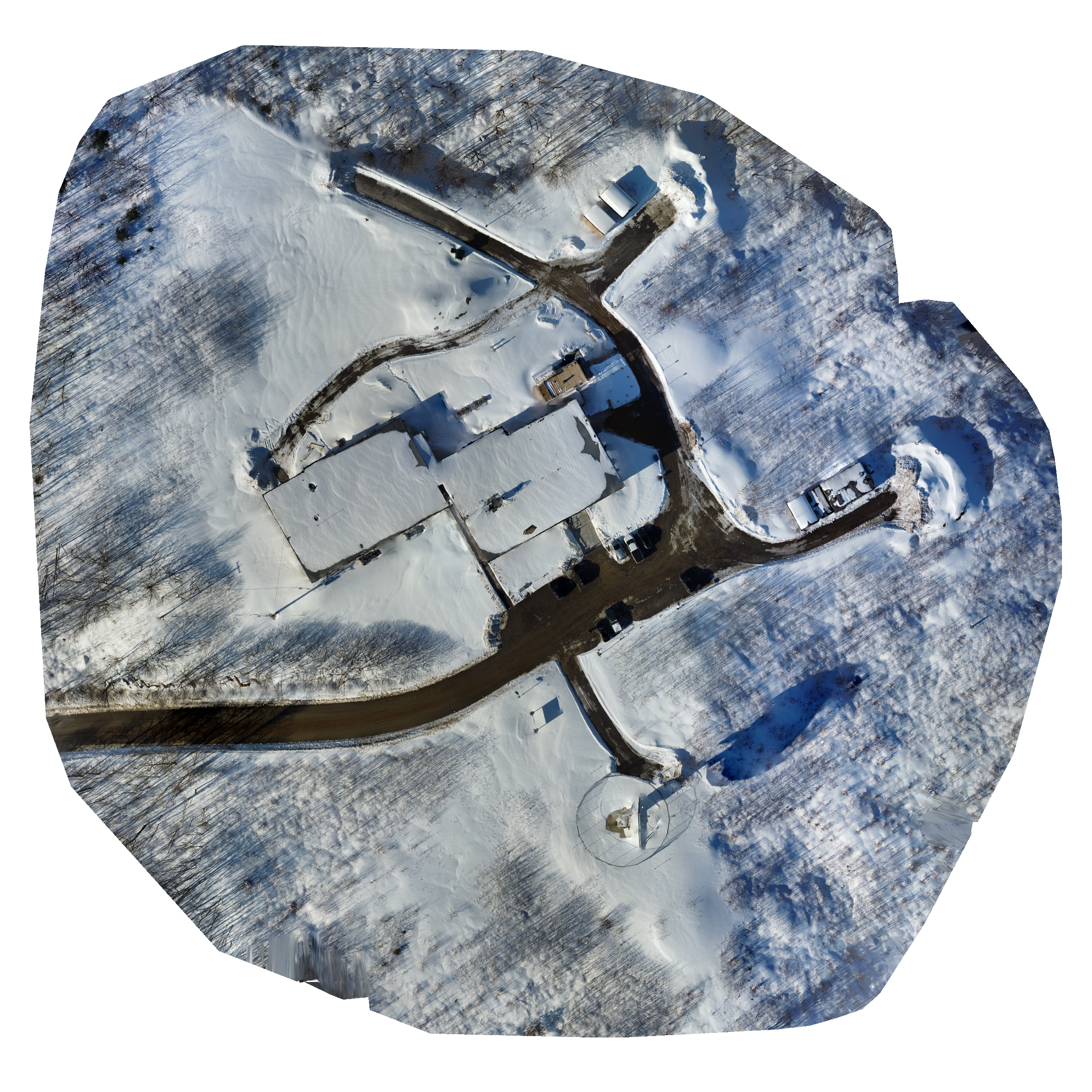
Orthomosiac Comparison
Here we can see two orthomosiac maps from flights on different day being compared side-by-side. Notable differences from the last flight include the collapsing of the tent structure behind the building next to the area of excavation as well as the removal of one of the excavators from the parking lot.
Flight Map
This map can be used to explore and view this days imagery. Please note that the full resolution imagery can be downloaded using the link provided either on this page or in your email notification.


3D View
In this you can explore the imagery in 3D, take screenshots of anything of note.