Drone LiDAR (Light Detection and Ranging) technology is revolutionizing forestry analysis by providing highly accurate 3D data of forest structures. Drones equipped with LiDAR sensors can map tree canopy heights, forest density, biomass, and terrain features with incredible detail. This allows foresters to assess forest health, track changes over time, and optimize management practices.
With LiDAR, it’s possible to detect and analyze even the most challenging areas, like dense vegetation, rugged terrain, and forest understory, that traditional methods often miss. This data helps in forest inventory, biodiversity monitoring, carbon stock estimation, and planning for sustainable harvesting. Drone LiDAR forestry analysis is not only faster and more efficient but also significantly enhances the accuracy and depth of forest management.
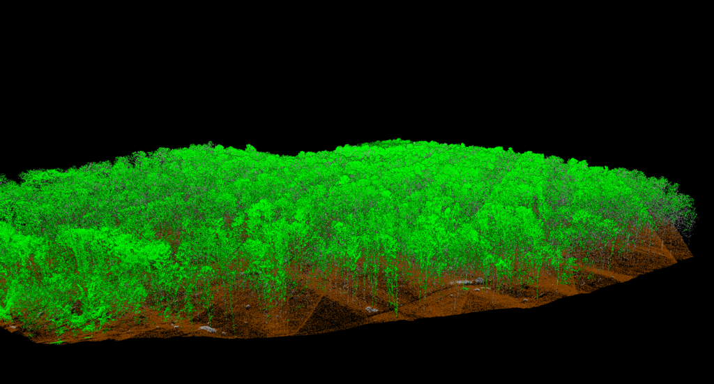
This data can provide deliverables such as tree inventories including tree counts, locations, and estimated heights.
Forestry Analysis Showcase
Traditional methods such as walking the terrain or using helicopters are expensive, less safe, and provide limited data of forests. Drones now allow the creation of detailed 2D and 3D maps in a cost-effective and flexible way. Advanced drones and sensors provide high resolution LiDAR data, allowing accurate digital terrain models and measurements of forest volume and height by penetrating the canopy.
Drones can be used throughout the forest lifecycle: after harvesting to identify damage, during early growth to check sapling survival, in young forests for growth management, and in mature forests to detect disease and damage.
Check out a sample analysis of aerial LiDAR over 1km of forest:
Send us a message!
Don’t hesitate to reach out with the contact information below, or send a message using the form