Aerial LiDAR Surveys & Scans
Revolutionize your project mapping with our Drone LiDAR services. Using LiDAR, our drones capture detailed, high-resolution 3D data of landscapes, terrain, and structures—quickly and safely. Ideal for construction, agriculture, forestry, and environmental monitoring, our surveys provide accurate up-to-date data for better decision-making.
Photography & Videography
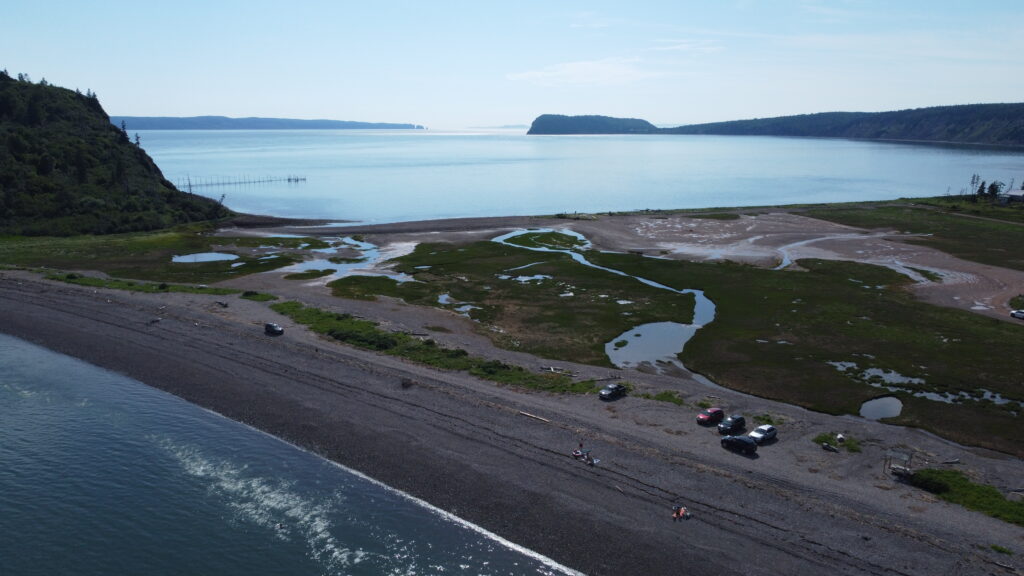
Our customizable drone photography and videography services offer high-resolution images and 4K video for property listings, marketing, and project updates. We also provide repeatable flight paths for capturing footage from different angles or times for ongoing monitoring and analysis.
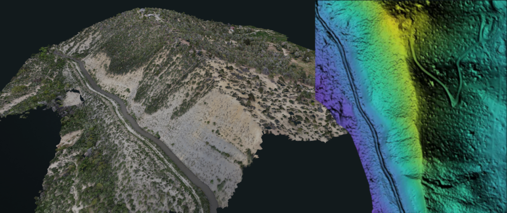
Mapping & 3D Modelling
Our drone services offer a range of high-quality data products, including 2D or 3D ortho-rectified maps, digital terrain and surface models, and 3D models. These products provide accurate and detailed information that can be used for a variety of applications such as land surveying, urban planning, and environmental monitoring.
Construction Monitoring
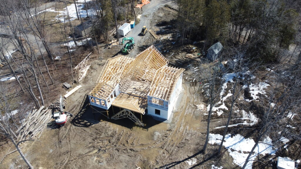
Aerial drone mapping is transforming construction with accurate, detailed data that’s hard to obtain otherwise. At Geodrone, we specialize in construction mapping, capturing high-resolution images and data to create 2D maps and 3D models for site analysis, design, planning, and monitoring.
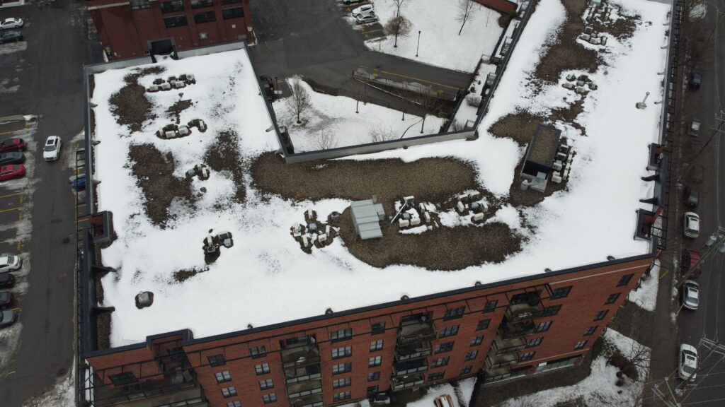
Building & Infrastructure Inspections
Building inspections are an essential part of property management and maintenance. At Geodrone we specialize in using aerial inspections to provide our clients with detailed and accurate information about the condition of their buildings by utilizing high-resolution images and videos of building exteriors and roofs. This allows us to provide a comprehensive view of any issues or potential problems.
GIS Services
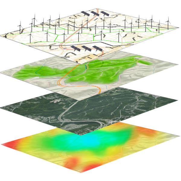
Geographic Information Systems is a technology that collects, analyzes, and visualizes spatial and geographic data. It helps interpret patterns, relationships, and trends in the environment, making it valuable for fields like environmental management, agriculture, and transportation.
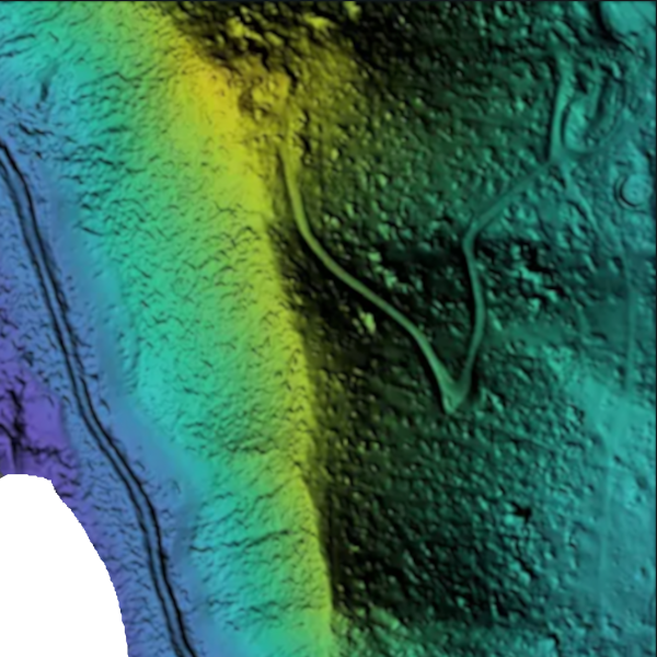
Elevation Models & Volumetric Analysis
Elevation models, like Digital Elevation Models (DEMs), show terrain height variations. Volumetric analysis uses this data to calculate the volume of materials in an area, often applied in construction, mining, and environmental studies for tasks like cut-and-fill calculations and flood risk assessment.
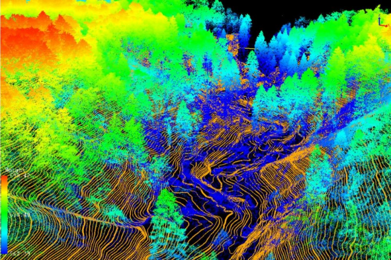
Forestry Analysis
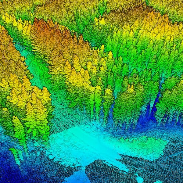
Drone forestry analysis uses unmanned aerial vehicles (UAVs) to capture high-resolution images and data of forests. This technology helps assess tree health, measure biomass, monitor forest growth, and track environmental changes, providing efficient and cost-effective insights for forest management and conservation.
Send us a message!
Don’t hesitate to reach out with the contact information below, or send a message using the form