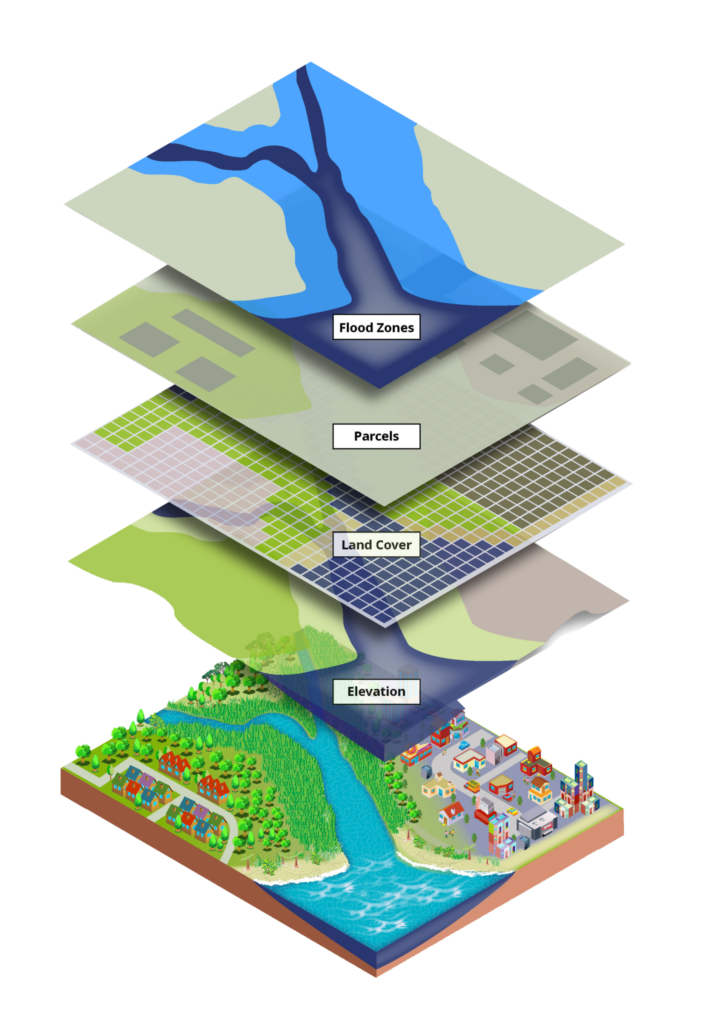
Geodrone offers a wide range of GIS services to help you analyze and present geospatial data. GIS, or Geographic Information Systems, is a suite of powerful tools that combine data from various sources, including maps, satellite images, and aerial photography, to create a visual representation of geographic features and information. We can provide you with accurate and reliable data, enabling you to make informed decisions and solve complex problems in a variety of field.
We specialize in providing custom GIS solutions tailored to your specific needs. Whether you need to map your property boundaries, assess environmental impact, analyze transportation networks, or monitor areas for change detection, we can provide you with the data and insights you need to make informed decisions. Our GIS services include the creation of 2D and 3D maps, point clouds, and models, as well as data analysis and interpretation, visualization, and reporting.
Send us a message!
Don’t hesitate to reach out with the contact information below, or send a message using the form